Self-guided Walks to try
All of the walking routes offered during the Somerby Festival of Walking are on public footpaths, bridleways, lanes roads and tracks and are open for walkers to enjoy at any time.
Self-guided route 1
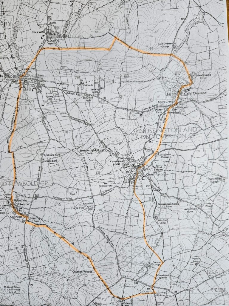
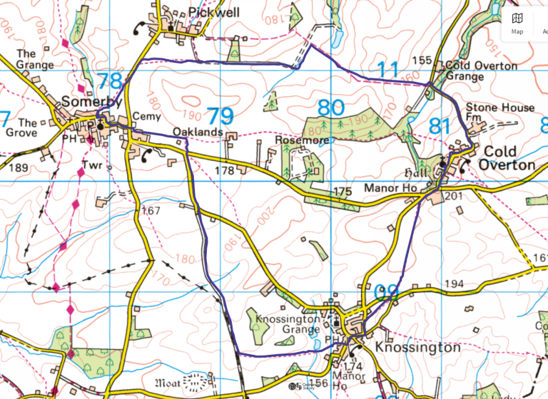
Somerby, Cold Overton, Knossington, Withcote Hall, Owston Circuit
Approx 10.5 miles
1. Starting from the High Street of Somerby take the footpath down the side of No 38 that goes through horse pasture and a cross-country course towards Pickwell. Before you reach Pickwell take the footpath on the right and follow the track until it is blocked by a gate. Turn right onto the bridleway towards Cold Overton.
2. When you reach the road turn right and follow it up the hill to Cold Overton and through the village until you reach the junction with the garden centre opposite. Turn right and first left towards Knossington. Not long after the turn, opposite Manor House, take the footpath on the left. Follow this path into Knossington (crossing over a road and carrying on before you get there) where you join the road opposite Larchwood Rise. Turn left and follow the road past the village hall and turn left onto Owston Road.
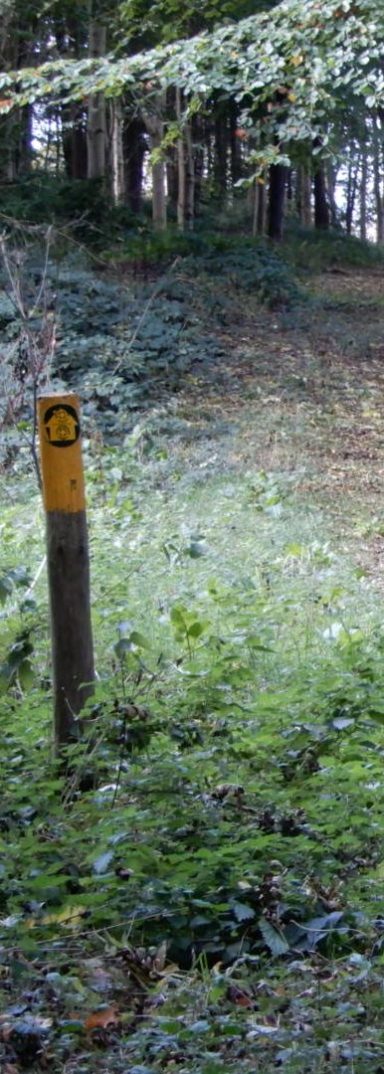
3. Where Owston Road bends to the right, go straight on (left turn)to the signed footpath and follow the track until the yellow topped post on the left. Follow this footpath through some cow pasture, past Preston Lodge and up to the main road between Tilton and Braunston. Cross the road and continue on the road signposted to Launde Abbey until the first footpath on the right which leads down to Withcote Hall.
4. Follow the way markers through the farmyard and turn right to go up the Withcote Hall driveway. Once again cross the main road and continue on the Leicestershire Round path through Owston Woods (still very muddy). Continue on this path to Owston, turning left to go down through the village and taking the road towards Newbold. Take the first footpath signed off to the right, just after the brook, and continue on the Leicestershire Round path back to Somerby.
Self-guided Route 2
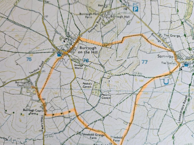
Somerby, Burrough on the Hill, Burrough Court Coffee Shop, Newbold, Somerby
Approx 5 miles
These directions are not intended to take the place of the map - you need the map as well - download and go!
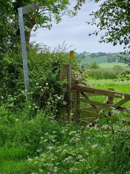
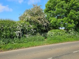
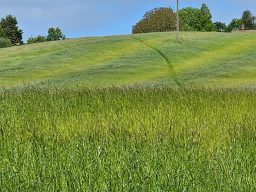
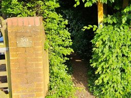
1. Starting from Somerby High Steet follow the pavement round onto Burrough Road and take the first footpath signposted off to the left – the sign is rather hidden by hedge growth, so keep your eyes peeled opposite where the word SLOW is written on the road. Walking slightly right of straight on across the field to a pedestrian gate. After going through the gate turn right and keep the hedge on your right for two fields. In the second of these fields after you have followed the hedge round the corner, at the end of short side there is a yellow topped post which seems to direct you straight ahead through the field gate in front of you. Don't take that gate, instead at the yellow topped post look to your right and you will see double field gates marked with a yellow arrow. Go through these gates and continue ahead with a couple of large trees on your left and behind them a small house. In the next field head downhill (leaving the small house directly behind you ) passing through a copse of trees. In the next field there is a path worn to the left, but the correct footpath goes up the hill in front of you passing close to the telegraph pole on top of the hill and down to the corner of the field. Onto the road in Burrough on the Hill and turn left.
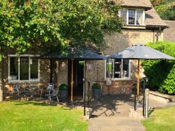
2. Just before the pub you will see the footpath sign going through the front garden of the last of a row of houses. Take this path going over three fields before coming to Marefield Road. Turn right and follow the road for a short way until you see a stile into Burrough Court on your left. Take the stile and after a few metres turn right through a gravel car park and go straight ahead until you see the sign for the coffee shop. Enjoy! (Note that the coffee shop is cashless payment only , and is not currently open at weekends, but keep and eye on their website as this may be changing. Check closing times.).
3. Exit Burrough Court the same way you entered back onto Marefield Road. Turn right and follow the road past the footpath you came down on, past a few houses, until you see the metal field gate with the footpath sign on the left. Go up the slope towards the far lefthand corner of the first field and then follow the track between two hedges and past some farm buildings until you come to Newbold Lane. Turn right and follow Newbold Lane all the way back to Somerby (don't be tempted by the gated road to Owston that you pass).
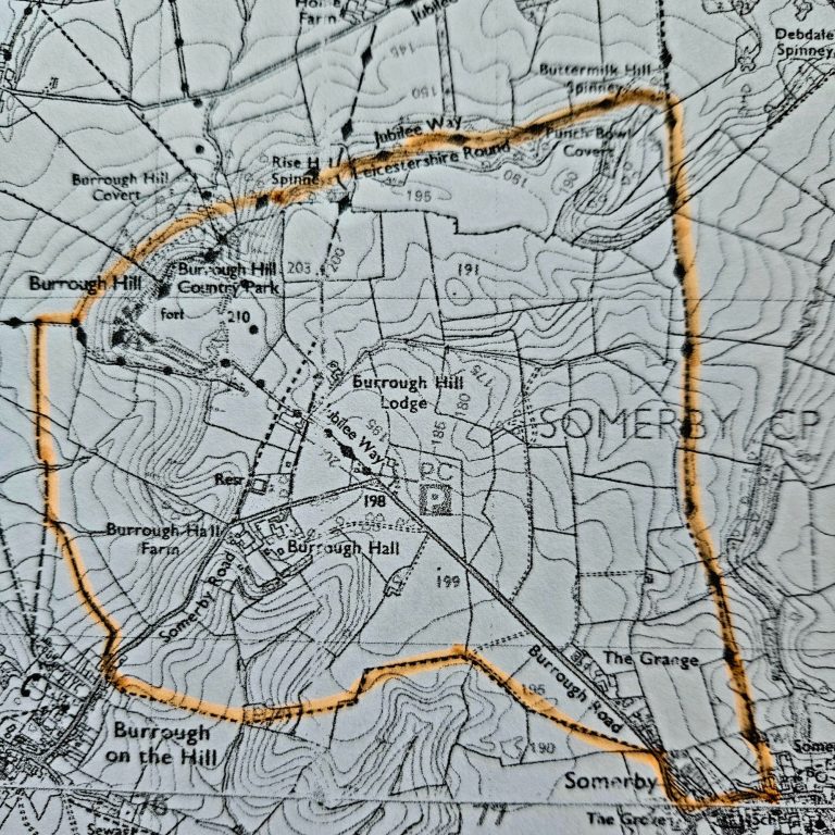

Self-guided Route 3
Somerby, Burrough Hill Fort, Burrough-on-the-Hill, Somerby
Approx 5 miles
These directions are not intended to take the place of the map - you need the map as well - download and go!
1. Starting from Somerby High Steet take the Leicestershire Round footpath between Nos 58 and 62 High Street towards Burrough Hill. This is a well used footpath well supported by yellow topped posts and the direction signs on the posts are accurate. After 3 fields you will come to a plank bridge over a stream and then in the next field you will find a yellow topped post that diverts you off the field margin and across the field (downhill). Head towards the tall tree that you see and you will find the plank bridge to the next field where you go straight ahead towards the gap in the trees ahead of you. Down the steps to the punchbowl (view of Little Dalby Hall ahead of you) and after you have passed through that field with the fence on your left and through the gate at the top you turn left to stay on the Leicestershire Round path. At the moment there is a blue hosepipe that now leads you to Dalby Hills Woods.
2. Continue through the woods and on towards Burrough Hill where you will see the hill rising in front of you. You may want to go straight up the hill to the views from the hillfort (see alternative route notes below) but we are going to walk round the skirt of the hill. part way up the hill, looking to the right you will see a farm gate (don't take this) and just above that a pedestrian gate. Take the pedestrian gate through a wooded area, over a plank bridge and down a slope before turning left to follow the permissive path through the trees. Straight ahead as you come out from the trees through a very large rabbit colony and as you come out from a narrow path through the gorse turn right down to a metal pedestrian gate.
3. Walk down with a ditch on your left until you see the first small earth bridge over the ditch. Turn left here and follow the clear path with Burrough village ahead of you. After a couple of fields you will come to a wooden pedestrian bridge where there is a footpath going straight ahead, but we are going to turn left immediately after the bridge and cross into the next field. Turn to the right and you will see in the middle of the field ahead of you two hedges close together (and a yellow topped pole). Take the path between those hedges up to the village. Cross the road and take the footpath between Nos 50 and 48.
4. Follow the path over the hill by the telegraph pole and down to a plank bridge that leads to a small wooded area. Up through the trees and following the yellow topped posts up hill to double field gates. Keep the hedge on your left now for the next two fields (at the end of the short side of the first field after the double gates there is a yellow post - don't go through this gate, continue round the corner, keeping the hedge on your left) heading towards the yellow topped post in the second field. Take the gate and go across the final field before you reach Somerby. Turn right and follow the pavement round to the High Street.
5. Have a well deserved pint at The Stilton Cheese Inn, pub of the year 2023!
Alternative Route Notes: (From para 2 above) If you would like to visit Burrough Hill Fort this time then go straight up the hill in front of you where you will see the remaining walls of the hill fort around the edges of the hill. Walk over to the viewpoint you will see on the opposite side of the hillfort (there are stone steps leading up to it). From here there are fine views to be had on a clear day. When you are ready to move on go down the steps and turn left where you will find the path down the hill, through the gorse. Once you reach the bottom of the hill turn right and proceed to the metal pedestrian gate and re-join the route at para 3 above.
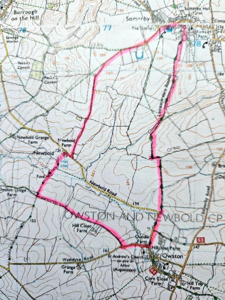
Self-guided Route 4
Somerby, Owston, Newbold, Somerby
Approx 5 miles - dog friendly (no stiles)
These directions are not intended to take the place of the map - you need the map as well - download and go!
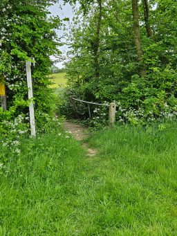
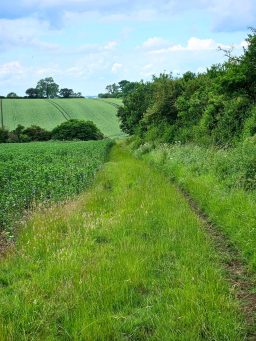
1. Starting from Somerby High Steet take the Leicestershire Round footpath down Manor Lane towards Owston. In the third grass field head down towards the farm track and you will see the electric fence 'gate' marked. Turn right (there is also a track going straight ahead up the hill at this point, but that is the track to the farm and not the route you want) and join the farm track until you see a pedestrian gate on your right. Take this and immediately turn left and continue through this field and the next until you see a metal pedestrian gate in the fence on your left. Take this and go down to the plank bridge and gate ahead of you. Once through the gate turn right and follow the path ( a little overgrown on 19th June) through to the next field where you turn left and follow the path uphill with the hedge on your left. Across a small plank bridge and turn left and follow the path around the field to another plank bridge at the bottom. Continue to follow the path until you come to the lane. Turn left towards Owston.
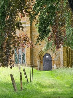
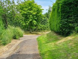
2. A short way up the lane you will come to a T junction with a house , 'Little Butt' on your right. Turn right here and walk up the lane past the church on your left. Almost opposite the church there is a footpath sign to the right, but ignore that and continue up the lane until a farm track on your right marked with a bridlepath sign. Turn right and follow this track up to the farmyard and continue straight on into the field, following the path with the hedge on your right until the path crosses over a gravel track. Turn right and walk down to a ford. There is a footbridge on the right.
3. Cross the ford or the footbridge and continue until you meet Newbold Lane. Turn right and (ignoring the gate at Newbold that leads back to Owston) follow Newbold Lane all the way back to Somerby.
Self-guided Route 5
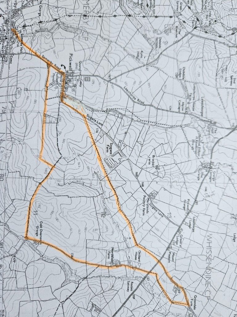
Somerby, Pickwell, Whissendine Lane, A606, Pickwell, Somerby
Approx 8 miles -
These directions are not intended to take the place of the map - you need the map as well - download and go!
1. Starting from the High Street of Somerby take the footpath down the side of No 38 that goes through horse pasture and a cross-country course towards Pickwell. Before you reach Pickwell take the footpath on the right and follow the track until it is blocked by a gate. Turn right onto the bridleway towards Cold Overton.
2. When you reach the road turn left (away from Cold Overton) and follow this lane past Northfield Farm until you come to the A606. This is a busy road with traffic travelling faster than it should – take care. There are two choices of route here:
(a) Cross the A606 to the footpath sign opposite and cross the first field until you see the metal pedestrian gate. This can be hard to see as it can get rather overgrown. There is a metal field gate (non-opening) in front of you and the pedestrian gate is to the right of it. Once through the pedestrian gate keep the hedge on your left for 3 fields and then in the last field before Greendale Farm, hedge on the right. Come to Whissendine Lane and turn left and walk back to the A606. Cross carefully to the stile that is now clear and visible directly across the road.
(b) Don’t cross the A606 but instead walk up the verge of the A606, very carefully, until you come to the stile which has now been cleared and is nicely visible.
3. Crossing the stile turn right and follow the mowed section of the field margin around the field until, directly across from the stile you came over there is a plank bridge, now clear, into the next field. Go straight ahead into the next field with the hedge on your right – here the field margin has not been mowed so you do have to wade through long grass. I found that about a metre or so in from the hedge there was a slight path where someone had passed before me, making it easier to walk. This second field is a big one with a bit of a right/left dogleg but keep going with the hedge on your right. You do then come to slightly easier walking where the path has been mowed. Keep the hedge on your right until you come to a large opening into the field on the right and the field margin ahead has not been cut – here go through the hedge and continue in the same direction but with the hedge on your left. You will see the domed roof of an agricultural building on your right.
4. There is a patch of rough ground in the next field but you can see the cut path ahead of you and the route is now clear to Stygate Lane. At the lane turn left and follow the lane up through Pickwell until you reach Somerby Road; turn left and return as you came out of Somerby by taking the stile through the cross-country course.
Self-guided Route 6
Somerby, Cold Overton, Knossington, Somerby
Approx 6.5 miles - There are quite a few stiles on this route with no dog gates so it is only suitable for dogs if you can lift them over stiles.
These directions are not intended to take the place of the map - you need the map as well - download and go!
1. Starting from Somerby High Steet take the footpath down the side of No 38, through the gate into the field and turn right. Follow the footpath through horse pasture and a cross-country course until it meets the road. Turn left and continue on the pavement until you see the footpath sign off to the right by a fuel tank. Follow the track, ignoring the turn off to the left which would take you to Pickwell, until you come to gates across the track and turn right here taking the bridlepath and keeping the hedge on your left until you see the footbridge through the hedge. Straight ahead up the field and through the gate, now going downhill with the hedge on your right. When you come to the lane turn right and go uphill to Cold Overton.
2. Take care at the top of the hill where the lane bends to the right as there is no pavement and no verge for a short while. Walk through the village, following the pavement through the churchyard until you come to the junction of Main Street with Somerby Road, with Gates Garden Centre opposite. If you fancy a coffee turn left here and divert to the coffee shop at the garden centre, otherwise, carefully cross the road and turn right taking the left turn towards Knossington. Almost immediately, opposite Manor House, take the signposted footpath off to the left over a low stile and meander for a few paces through the pine trees before the sheep pasture. Continue straight across and then follow the signed footpath across a number of fields, across a road and on to Knossington.
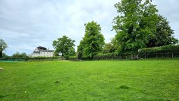
3. Emerging onto the road opposite Larchwood Rise, cross over to the pavement and turn left and follow the road around (be careful going around the corner as the pavement disappears for a while and there is no verge to speak of. Go past the Village Hall until you see the junction with Owston Road. If you fancy coffee, a pint or lunch, continue on Main Street round the corner to the right where you will find the Fox & Hounds pub, otherwise, take Owston Road until you see Rose Cottage on your right and immediately afterwards turn right into the playing fields. Continue straight ahead with the boundary on your left following the marked footpath where you will come across a lovely pond which you pass on your right. Follow this footpath directly across sheep pasture and a couple of arable fields until you emerge onto Bruces Lane. Turn right and follow this track until you come to Knossington Road with the refuse tip on your left. Turn left and follow the road towards Somerby. There is no pavement here so please follow the Highway Code and walk on the right hand side of the road facing the oncoming traffic and take care as you walk towards the brow of the hill where oncoming traffic may not see you until quite late.
4. When you come to the junction with Oakham Road, cross over carefully and take the pedestrian gate into the field. Cross straight over this first field and when you cross into the next field turn left and follow the footpath over a couple of fields and through the farm yard onto the pavement. Cross the road and take Somerby High Street back to your starting point.
We need your consent to load the translations
We use a third-party service to translate the website content that may collect data about your activity. Please review the details in the privacy policy and accept the service to view the translations.